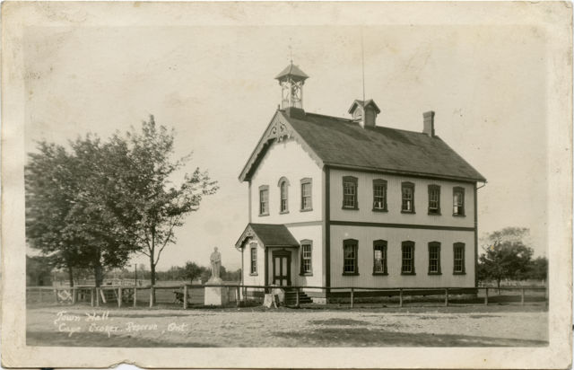
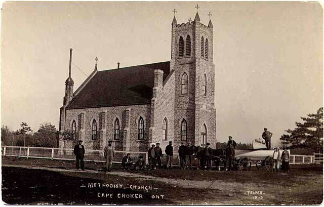
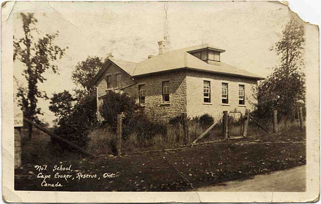
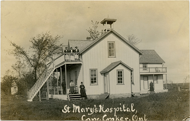
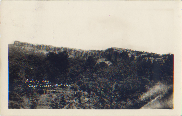
Cape Croker
The town formerly know as Cape Croker, as of January 21, 1992, is now known as Neyaashiinigmiing. The name Neyaashiinigmiing in the Ojibwe language means "at/by the point-of-land portage" referring to the reserve being located at the Cape Croker portage.
Ruins of what evidently were forts erected by fur traders are to be seen at Cape Croker, Stokes Bay, Red Bay and Southampton.
Ruins of what evidently were forts erected by fur traders are to be seen at Cape Croker, Stokes Bay, Red Bay and Southampton.
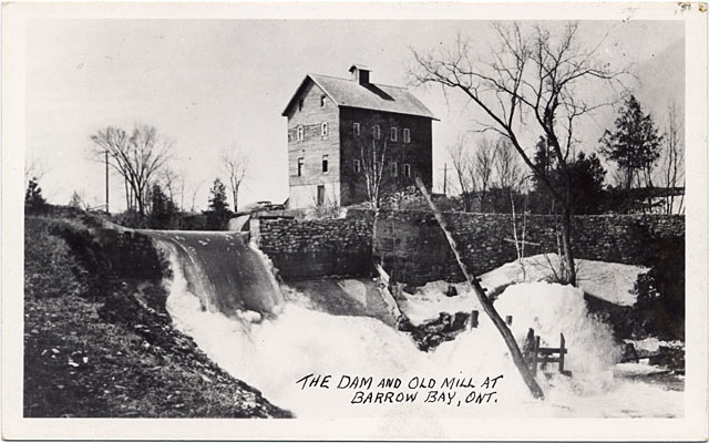
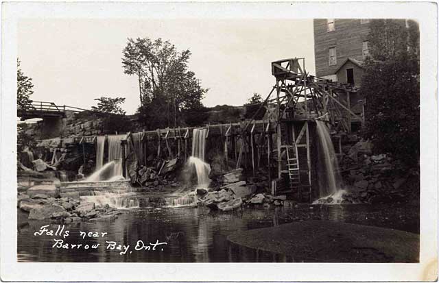
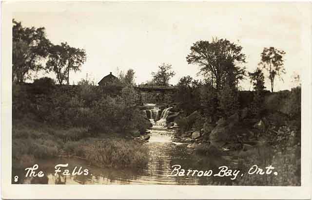
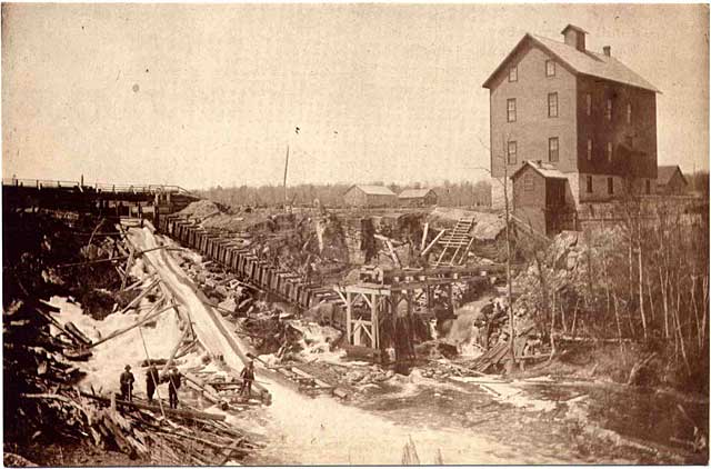
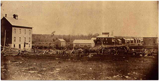
Barrow Bay
In The History of the County of Bruce and the Minor Municipalities Therein by Norman Robertson, published in 1906, he notes besides Lion’s Head there are but three villages in Eastnor Township—Barrow Bay, Spry and Stokes Bay. Much of the historical information on this page comes from that book.
The first European settlers in Eastnor favoured the vicinity of Lion’s Head, however Francis Waugh settled near Hope Bay, and Joseph Eveleigh and Patrick Judge, at Barrow Bay. The earliest attempt to establish a manufacturing industry in the township was in 1874, when a saw-mill, built and run by Patrick Judge, was put in operation at Barrow Bay. Some three years later the same man had a grist-mill of one run of stones; this mill was more used for "chopping" than for flour.
In 1883 Messrs. Judge and Inksetter built a steam saw-mill at Barrow Bay, and there, in 1892, the Barrow Bay Lumber Company built a large, roller-process grist-mill.
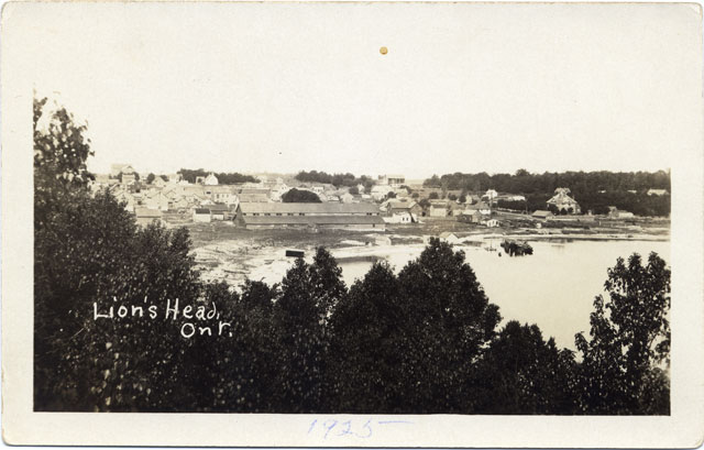
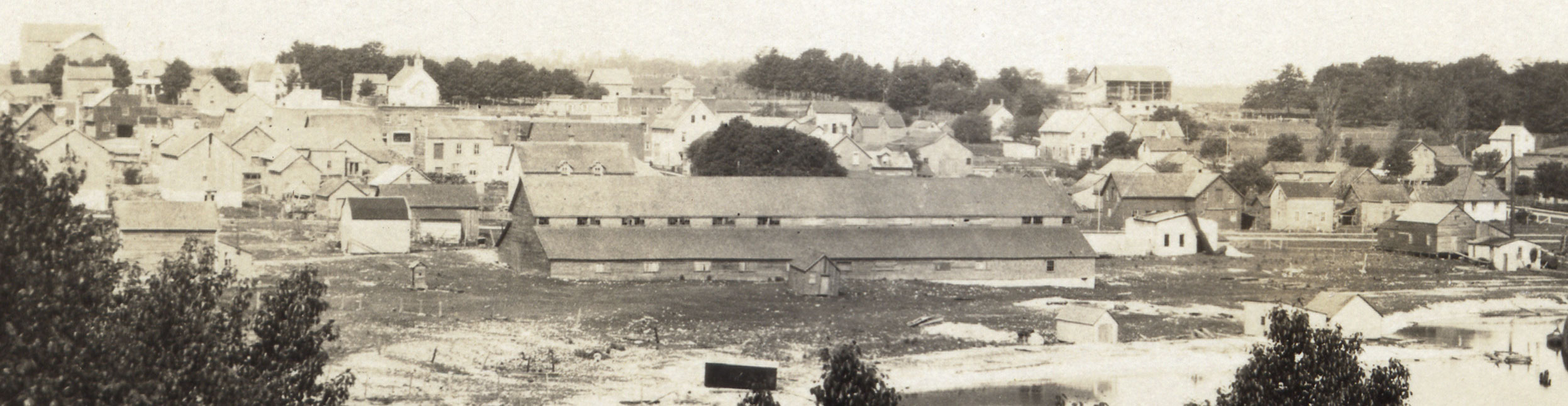
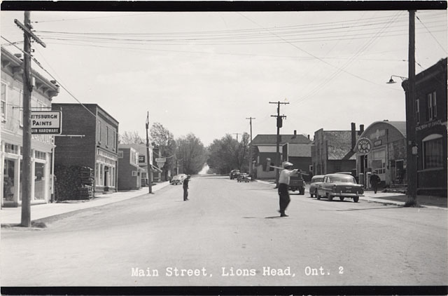
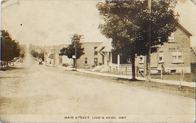
Lion’s Head
The first European settlers in Eastnor Township favoured the vicinity of Lion’s Head. In the 1870s and 1880s, steamboats plied the coast visiting Owen Sound, Wiarton and the peninsula, including Lion’s Head and Barrow Bay. To accommodate the ships, a 200’ long wharf was constructed in Lion’s Head in 1883.
James E. Kraemer has an article on the Socio-Postal History of the Municipality of Northern Bruce Peninsula, with extensive notes on Lion’s Head, in Vol. 7, No. 1 of The Georgian Courier, a newsletter of The Grey, Bruce, Dufferin and Simcoe Postal History Study Group from November 2004. The study group is part of the Postal History Society of Canada.
James E. Kraemer has an article on the Socio-Postal History of the Municipality of Northern Bruce Peninsula, with extensive notes on Lion’s Head, in Vol. 7, No. 1 of The Georgian Courier, a newsletter of The Grey, Bruce, Dufferin and Simcoe Postal History Study Group from November 2004. The study group is part of the Postal History Society of Canada.
Stokes Bay
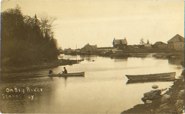
John Shute, a local resident who had opened the first general store in 1883, surveyed and subdivided the hamlet of Stokes Bay, previously known as Big River, but renamed in 1878. In 1906 there were sanguine expectations for the ultimate development of the village, as it had the trade of a good part of Lindsay and St. Edmunds, and also a good wharf, so that shipments could readily be made from there. The lighthouse on Lyal Island, at the entrance to Stokes Bay, has been a guide to mariners since 1885. The mail was carried to Tobermory on foot from Stokes Bay until the Stokes Bay post office was opened in 1878.
If you’re interested in further info on Stokes Bay, James E. Kraemer has a detailed article in the Vol. 6 No. 6 issue of The Grey, Bruce, Dufferin and Simcoe Postal History Study Group newsletter from August 2004. The study group is part of the Postal History Society of Canada.
If you’re interested in further info on Stokes Bay, James E. Kraemer has a detailed article in the Vol. 6 No. 6 issue of The Grey, Bruce, Dufferin and Simcoe Postal History Study Group newsletter from August 2004. The study group is part of the Postal History Society of Canada.
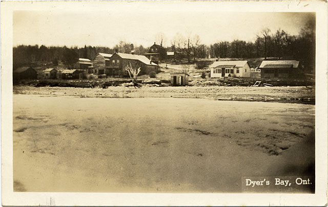
Dyer’s Bay
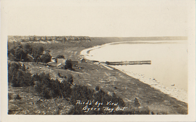
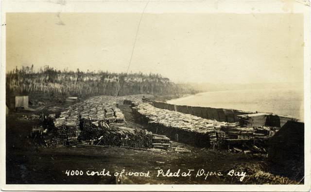
The road west side main road of the Peninsula was opened through to Lindsay in the year 1870, and that from Lion’s Head to Dyer's Bay in 1880. In 1881 Dyer's Bay post-office was established.
EXTRACT FROM THE REPORT OF COUNTY VALUATORS, 1901.
EXTRACT FROM THE REPORT OF COUNTY VALUATORS, 1901.
Owing to the limited time at our disposal, we are unable to give complete reports of the townships of Lindsay and St. Edmunds. These townships possess very little good land. St. Edmunds is largely a waste. The inhabitants of Dyer’s Bay and Tobermory sections are at a great disadvantage, being so far removed from a line of railroad, and the roads leading to those places are in an almost impassable condition. Land is so sparsely settled that it is utterly out of the power of the people of these townships to maintain the roads.
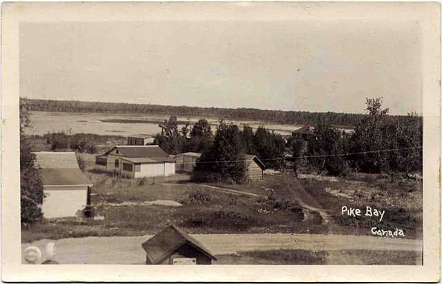
Pike Bay
A store and sawmill were established in Pike Bay, and schooners called at the port, whose main commodity was ties, posts, tambark and lumber. At one time early in the 20th century, a fire swept through the settlement.